
Agriculture
Agriculture (Climate/Air, Soil, Water, Technology)
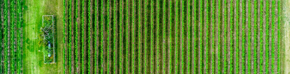
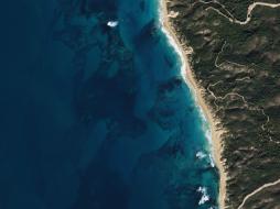
Geospatial technologies are helping to establish more effective and efficient farming techniques. They are used to analyze soil data and crop health from a distance, with large areas covered all at once, and they help answer these questions: What is the most suitable crop to plant? Where should they be planted? What nutrient deficits may be hindering plant growth? Geospatial technologies are fully integrated into and widely accepted by government agencies for managing programs that support farmers and protect the environment. These technologies can help increase food production and security in different parts of the world.
Soil mapping helps understand soil suitability and Agriculture Risk Coverage for various land use activities; it is essential for preventing environmental degradation associated with the inappropriate use of land. Geospatial technologies are used to identify soil types in an area and to delineate soil boundaries. These technologies also allow the identification and classification of soil. Soil maps are widely used by farmers in developed countries, who need to manage soil nutrients and maximize yield.
Water availability is vital information for crop production in any region; water resources need to be appropriately and efficiently managed for proper irrigation. Integrated use of satellite remote sensing and GIS, assisted by ground information, is an efficient pairing for identifying major crop types and their conditions and to evaluate irrigation performance. The plant's irrigation requirements can be determined by considering factors such as evapotranspiration, net irrigation requirement, field irrigation requirement, gross irrigation requirement, and monthly total volume of water required, and organizing them in a GIS environment.
Also, increasing incidences of pests and weeds will decrease crop production. Crop infestations and their effect on health status may be directly visible in the satellite imagery or revealed through vegetation analysis techniques. Therefore, GIS plays a vital role in mapping out infested areas and crop damage. This information supports the development of pest management best practices (BP) and an effective integrated pest management plan (IPM).
Cloudeo supports the Agriculture Industry throughout the farming lifecycle:
Crop Selection
- Assess the feasibility of the crop considering climate and quality of land.
- Compare crop productivity with other alternatives.
- Forecast production yield.
Land Preparation
- Assess the effects of any disease from the previous cultivation and determine steps needed to minimize this impact.
- Determine soil amendments which are required to bring the land to its normal fertility, depending upon the earlier crops and fertilizer used.
- Create layout and design for efficient irrigation.
- Incorporate latest techniques for field clearance and associated costs.
Seed Sowing
- Set the appropriate time to sow.
- Determine optimal weather conditions at sowing time.
- Establish best practices for sowing.
- Control seed sowing depth.
Irrigation
- Find critical time for irrigation.
- Calculate the volume of water needed.
- Set frequency of irrigation.
Crop Growth
- Optimize the number of plants per unit of area. At times, plants may be too densely planted. Farmers must reduce density for the healthy growth of plants.
- Monitor the average growth rate of the crop in normal conditions.
- Compare crop growth rate, leaf size, crop color, etc. with expected growth for given situations and input.
- Find interventions needed to maintain likely growth.
- Determine frequency, quantity, and method for fertilization.
- Set the proper time, frequency, and method for plowing.
- Set the appropriate time, frequency, and method for weeding.
- Prepare for pest and weed attacks, detect such attacks' symptoms, prepare precautionary measures that can be taken in advance to avoid these attacks, take immediate actions to combat them, determine the quantity of pesticide to be used per acre, find best practices for pesticide applications.
Harvesting
- Set proper time and method for crop harvesting.
 Airbus Defense and Space OneAtlas Analytics leverages premium Airbus satellite imagery, AI, and cloud computing technologies to extract actionable insight fast, in a cost-effective w... |  Airbus Defense and Space OneAtlas Data is a unique place for quick and easy access to updated High resolution satellite imagery and layers at your fingertips. Based on the Airbus con... |  Planet Power your applications and analytics with seamless Planet Basemaps built from the most recent imagery over broad areas. With daily, global imaging, Planet s... |
 Planet Frequent, global imagery is a powerful source of truth. But harnessing that data can be challenging, even for the most seasoned users, and manual, time-inten... |  Planet Frequent, global imagery is a powerful source of truth. But harnessing that data can be challenging, even for the most seasoned users, and manual, time-inten... |  Planet Access and download past imagery from the PlanetScope Archive catalogue over any area of interest. PlanetScope satellites capture daily imagery going back to... |
 Planet Stay ahead in today’s rapidly evolving business landscape with a persistent view of business operations and assets – everywhere on Earth. But traditional ima... | 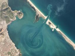 Planet Select 10,000km² of PlanetScope satellite imagery al a carte. Perfect for projects with strict scopes and deadlines, customers can pre-pay for imagery, past... |  Airbus Defense and Space Pleiades is an optical satellite constellation providing very high-resolution products (50cm) with a 20-km swath. Both the space and the ground segment have... |
 Sparkle Have you always wanted to use AWS but didn't want to run over budget? Then Prepaid AWS Cloud is for you. Prevent cost overruns by pre-purchasing just the amo... |  Planet Access the rich archive of imagery from the longest running satellite in the Planet catalogue, RapidEye. Perfect for a “high level” overview, the 5-meter res... | 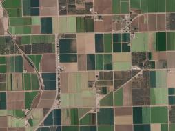 Planet With an industry-leading combination of coverage and cadence, Planet delivers Earth imaging data at unprecedented scale. Planet’s 15 SkySat satellites gather... |
 Planet Get a snapshot of your area of interest to discover patterns, detect early signals of change, and make timely, informed decisions. With 15 SkySat satellites... | 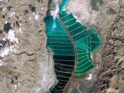 Airbus Defense and Space The SPOT imagery products offer high resolution over broad areas using the SPOT satellites. An acquisition covers large areas in a single pass at resolutions... |  Airbus Defense and Space TerraSAR-X reliably provides high-resolution SAR imagery with a resolution of up to 0.25m independent of weather conditions and illumination. The products al... |
 21AT TripleSat Constellation Archive has the right tools when you need a time-series of images to map or monitor your area of interest. You can r... |  21AT TripleSat Constellation Tasking has the right tools when you need a time-series of images to map or monitor your area of interest. With a st... |  HySpeed Computing VegetationVitality - Monitoring utilizes scientifically validated and industry-accepted multispectral vegetation indices to deliver fundamen... |
 Sparkle Workshop and Training Solutions is the best way to host your internal and external company training remotely and securely, without paying for aging physical... |  Airbus Defense and Space WorldDEM™ is a 12m Digital Surface Model (DSM) with unprecedented quality, accuracy and coverage. WorldDEM™ provides a reliable and precise reference layer t... |  Airbus Defense and Space WorldDEM™ Streaming grants global access to WorldDEM™ (12m) and WorldDEM4Ortho (24m) via streaming. Browse, discover, and experience the global WorldDEM™ dat... |