
Forestry
Forests play an essential role in today's society and serve as sources for producing paper products, lumber, and fuelwood. Also, forests make freshwater from mountain watersheds, purify the air, offer habitat to wildlife, and offer recreational opportunities, among many other ecosystem services. Balance ecological and recreational functions, accurate and precise information about forest structure and its biophysical parameters are needed to support informed decision-making and sustainable management.
Many natural resource managers and policymakers' decisions regarding forests are linked with the geospatial data covered by conventional forest inventory methods. Remote sensing data fills the existing forest monitoring information gaps, particularly in many developing countries. Through remote sensing, information retrieved through space- and airborne acquisition methods offer a synoptic view over large or inaccessible areas. The Forest Resources Assessment supports global tree cover and forest land use monitoring. Monitoring programs implement a systematic framework to obtain information about forest cover changes and forest land-use changes globally.
Carbon emissions are partially compensated by forest growth, forestation, and soil carbon pools' rebuilding following afforestation. However, the global distribution of terrestrial carbon sinks and sources is highly uncertain. Initiatives constraining forest carbon estimates inaccuracy is essential to developing new techniques and methodologies to support information needs of effective forest management and future climate mitigation actions.
Advances in close-range and remote sensing technologies drive innovations in forest resource assessments and monitoring at varying scales. Data acquired with airborne and spaceborne platforms provide us with higher spatial resolution, more frequent coverage, and increased spectral information. Recent developments in data include aerial photography, multi-spectral scanner (MSS), radar (Radio Detection and Ranging), Lidar (Light Detection and Ranging) laser, and Videography have helped detect, identify, classify, evaluate, and measure various forest cover types and changes. Cloudeo supports its users in multiple areas of web and mobile applications, which include:
- Assessing and managing wildlife habitat
- Assessing slope failure and soil erosion
- Assessment of wind damage
- Assessment of climate change consequences as drought, bugs, and diseases
- Basal area growth estimation
- Biomass estimation
- Crown cover estimation
- Canopy density estimation
- Crown diameter measurement
- DBH estimation
- Dead declined trees
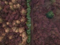
- Detecting deforestation and forest degradation
- Detecting forest roads
- Detecting forest trees health (vigor and stress)
- Evaluating and managing forest recreation resources
- Forest cover area measurement
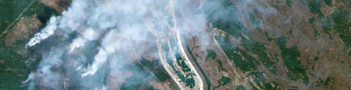
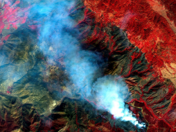
- Forest fire detection
- Forest fire hazard
- Forest inventory
- Forest management
- Forest monitoring
- Forest roads planning
- Forest species level mapping
- Forest stands volume estimation
- Forest stands woody biomass estimation
- Forest tree species differentiation
- Forest trees diseases and insect’s infestation
- Forest trees nutrient deficiency
- Forest trees under air, soil, and water pollution
- Forest trees water stress detection
- Mapping trees spatial distribution
- Burned and flooded forest mapping/monitoring
- Monitoring logging activities
- Number of trees per unit area (density)
- Reforestation and afforestation monitoring
- Species composition
- Stand size
- Tree age estimation
- Trees annual growth estimation
- Thinning volume estimation
- Timber harvesting planning
- Timber volume estimation
- Tree height estimation and measurement
- Counting of trees in urban areas and plantations
 MAPSGEO sarl Do you need high-resolution imagery over a whole country or large area for your mapping project? Then 21AT Basemaps / LAM is perfect for the occasion. Since... |  CATALYST - A PCI Geomatics brand Our rich set of capabilities are designed for today's top geospatial professionals in REMOTE SENSING. PHOTOGRAMMETRY and EARTH OBSERVATION SCIENCE. C... |  cloudeo You have a plan and budget right now, which needs geo resources like data, software, or cloud resources within the next year, but you do not know exactly?... |
 Airbus Defense and Space Elevation1 provides highly accurate up to 1.5m vertical accuracy at 1m grid spacing elevation information anywhere in the world, independent of relief and we... | 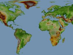 Airbus Defense and Space Elevation30 is a unique worldwide 3D geographic reference database with a vertical accuracy down to 6m at 30m grid spacing specifically designed for large ar... | 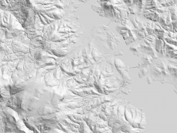 Airbus Defense and Space Elevation4 provides highly accurate up to 3m vertical accuracy at 4m grid spacing elevation information anywhere in the world, independent of relief and weat... |
 Airbus Defense and Space Elevation8 provides highly accurate with vertical accuracy down to 3m at 8m grid spacing elevation information anywhere in the world, independent of relief a... |  L3Harris Geospatial The Geospatial image analysis software used by GIS professionals, remote sensing scientists, and image analysts to extract meaningful information from satell... | 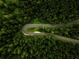 VTT |
 VTT | 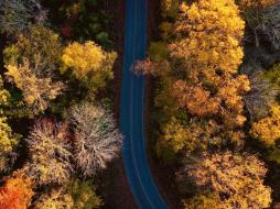 VTT | Hexagon Keep your high-resolution data locally with Hexagon Satellite imagery. Simply select your area of interest, the dataset you need, and get your data delivered... |
Hexagon Keep your high resolution data locally with Hexagon Pixel Delivery. Simply select your area of interest, the dataset you need, and get your data delivered fa... |  Hexagon The HxGN Content Program Streaming Aerial Imagery Service provides login-only access to an extensive online library of 30 cm and 15 cm (urban areas) ortho-re... | 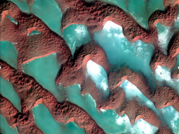 SI Imaging Services Access 1-meter panchromatic (PAN) and 4-meter multispectral (MS) image repository data for various applications, gathered by a high-performance remote sensin... |
 SI Imaging Services The latest high-performance remote sensing satellite images providing 1-meter panchromatic (PAN) and 4-meter multispectral (MS) image data for various applic... |  SI Imaging Services Providing 0.4-meter panchromatic (PAN) and 1.6-meter multispectral (MS) archived satellite image data for applications requiring extreme precision imagery ga... |  SI Imaging Services Access 0.5 meter panchromatic (PAN) and 2 meter multispectral (MS) image data repository gathered by a high-performance remote sensing satellite for various... |
 SI Imaging Services Providing 0.4-meter panchromatic (PAN) image and 1.6-meter multispectral (MS) image data for applications requiring extreme precision. Track detailed changes... |  SI Imaging Services KOMPSAT-3 Tasking offers access to the latest images gathered by a high-performance remote sensing satellite providing 0.5-meter panchromati... |  Novlum Inc. The high-quality 30-meter DTM maintains the input Digital Surface Model (DSM) seamlessly and void-free with flattened water bodies. NakedEarth... |