
Consulting Services
“Data is the New Oil” - you might have heard this a few times before. Like oil, data needs refinement to be useful. Choosing and processing the right geodata helps get the best output, both timely and cost-effective. Let our geospatial experts help you find what fits your requirements.
The benefits of using cloudeo’s consulting services are:
Extra Support
Sometimes companies hit a significant roadblock but don’t necessarily have the resources to fix it, while employees still have to focus on their day-to-day operations. Cases such as these new projects typically require reprioritizing employees’ core job responsibilities. But hiring new employees to fill these gaps doesn’t always make sense because many projects are finite.
At times like these, the cloudeo team serves as a temporary, highly skilled resource. We bring extensive experience working with many companies. By hiring a contracted team, permanent employees are not pulled away from their job duties.
Specialized Skills
Our customers gain access to a specialized skill set that might not exist in-house. By bringing us in, they can work with a group of professionals with skills encompassing the breadth of the geospatial industry, from data and software to analytics and infrastructure. We offer a highly specialized team only for the amount of time needed, saving costs from long-term contracts.
Confidential and Secure
When companies are working on a challenging problem or a controversial project, they may require external consulting and support. Cloudeo works discreetly, confidentially, and efficiently with our clients to find the best solution for their needs.
 Cloudflight Processing huge amounts of data can consume a lot of time and resources. We help you to spot your performance issues and speed up your algorithms. |  cloudeo You have a plan and budget right now, which needs geo resources like data, software, or cloud resources within the next year, but you do not know exactly?... |  HySpeed Computing LandMask is a geoservice that explicitly masks land and other non-aquatic components, such as vegetation, snow and ice, from water in each s... |
 Intermap Technologies The geo service NEXTMap Analytics – Profile provides quick and easy access to terrain profiles anywhere on the globe. Visualize the topograp... |  Intermap Technologies The geoservice NEXTMap Analytics – Value provides precise elevation information at any point in the world. Based upon highly accurate NEXTM... |  Intermap Technologies The geospatial service NEXTMap Analytics – Viewshed provides instant 360° communications coverage map, visibility, and obstruction analysis... |
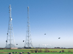
 Intermap Technologies Wireless network design and the installation of antennas requires an understanding of the best possible location and height of communication towers so that n... |  cloudeo To get a literal “high-level overview” of any plot of land (for example, to monitor long-term and short-term changes from construction, infrastructure, or na... | 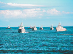 Maerospace Corporation With billions of dollars worth of goods crossing the oceans at any time, knowing when your ship comes in can swing time-sensitive markets. TimeCaster... |
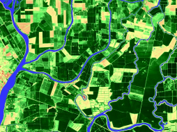 HySpeed Computing VegetationVitality - Monitoring utilizes scientifically validated and industry-accepted multispectral vegetation indices to deliver fundamen... |  Hochschule für Wirtschaft und Umwelt Nürtingen-Geislingen Visibility Analysis shows if radio masts, wind turbines, transmission lines, and other similar infrastructure installations are visible from... |  HySpeed Computing WaterExtent - Monitoring provides global insights on the location and quantity of one of the planet’s most valuable resources – water, which... |
 Sparkle Workshop and Training Solutions is the best way to host your internal and external company training remotely and securely, without paying for aging physical... |