
TripleSat Constellation Tasking has the right tools when you need a time-series of images to map or monitor your area of interest. With a standard tasking window of 45 days (under good weather conditions) to 90 days (for bad weather conditions), you can request panchromatic imagery (PAN) in a resolution of 0.8 meters, or multispectral imagery (MS) in 3.2 meters, over anywhere in the world, excluding China (the minimum order is 100 km2).
Product Description
The TripleSat Constellation is a system of three identical Earth Observation satellites flying in the same sun-synchronous orbital plane. Their electro-orbital imaging system can produce panchromatic imagery at a resolution of 0.8 meters, and multispectral imagery at 3.2 meters. With an orbital period of around 90 minutes and an approximate 24 km wide swath, the system offers a daily acquisition capacity of 500,000 km2. New imagery is transferred within 5 days of acquisition.
TripleSat Constellation data can be used to identify and analyze nearly 100 different land cover features, from man-made structures and surfaces to agriculture fields, bodies of water, bare land and rock, forests, and more. A time series of images can be used to detect or monitor change in areas and features of interest for applications like insurance, environmental regulation, and Business Intelligence. It is an ideal solution for tasks like surveillance and analysis for agriculture monitoring, precision farming, natural disasters, forest management, ocean and water monitoring, and land cover classification – just to name a few.

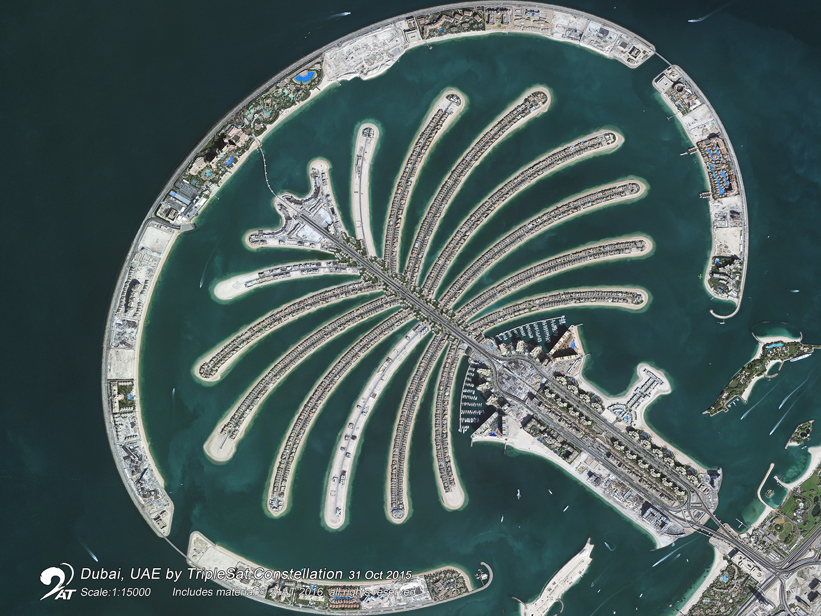
Dubai, UAE, TripleSAT, 31.10.2015

Lelystad, Netherlands, TripleSAT, 07.05.2016

Abu Dhabi, UAE, TripleSAT, 25.01.2016

London, UK, TripleSAT, 01.04.2016

Misano, Italy, TripleSAT, 29.08.2016
Provider:
- 21AT
On demand
Resolution
MSI
Geolocation accuracy
Acquisition capacity
Incidence angle
Access mode
Format
Product details
Delivery package specifications
- L1 (with RPCs):
- Bundle:PAN + 4 MS bands (R/G/B/NIR), TIFF
- L2 (no RPCs):
- Bundle: PAN + 4 MS bands (R/G/B/NIR), GeoTIFF
- Pansharpened Nature Color (R/G/B), GeoTIFF
- Pansharpened Color Infrared (R/G/NIR), GeoTIFF
- Pansharpened 4 bands (R/G/B/NIR), GeoTIFF
Please note
- For ortho and mosaic products please contact us.
- The service is available for customers living in one of the following countries:
Austria, Belgium, Bulgaria, Denmark, Germany, Estonia, Finland, France, Greece, Ireland, Iceland, Italy, Croatia, Latvia, Liechtenstein, Lithuania, Luxembourg, Malta, Netherlands, Norway, Poland, Portugal, Romania, Sweden, Slovenia, Slovakia, Spain, Switzerland, Czech Republic, Hungary, Cyprus, United Kingdom
Pricing / Licensing
The minimum order size for this service is 100 km2, with a minimum length of each side of the polygon of 5 km.
The price is 13.50 €/km2 with a cloud coverage ≤ 15 %. The price will increase by 25 % for a cloud coverage ≤ 10 % and by 50 % for a cloud coverage ≤ 5 %.
21AT EULA and cloudeo Terms & Conditions apply.