

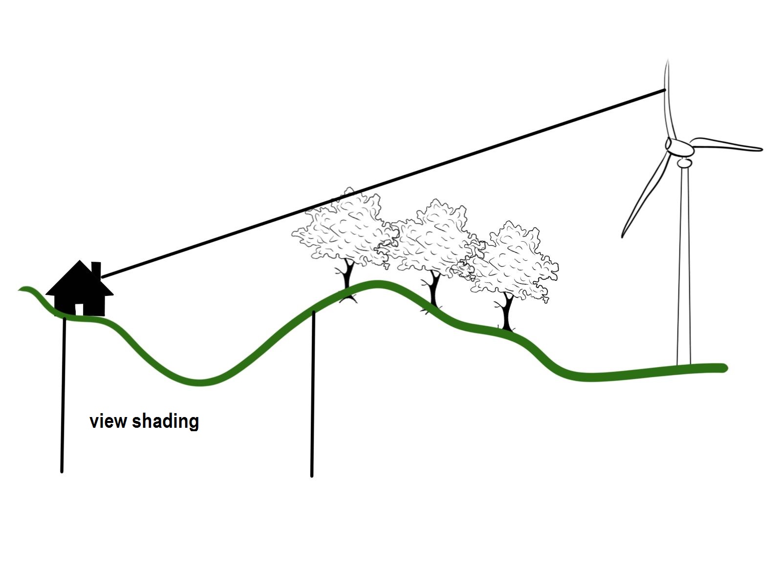
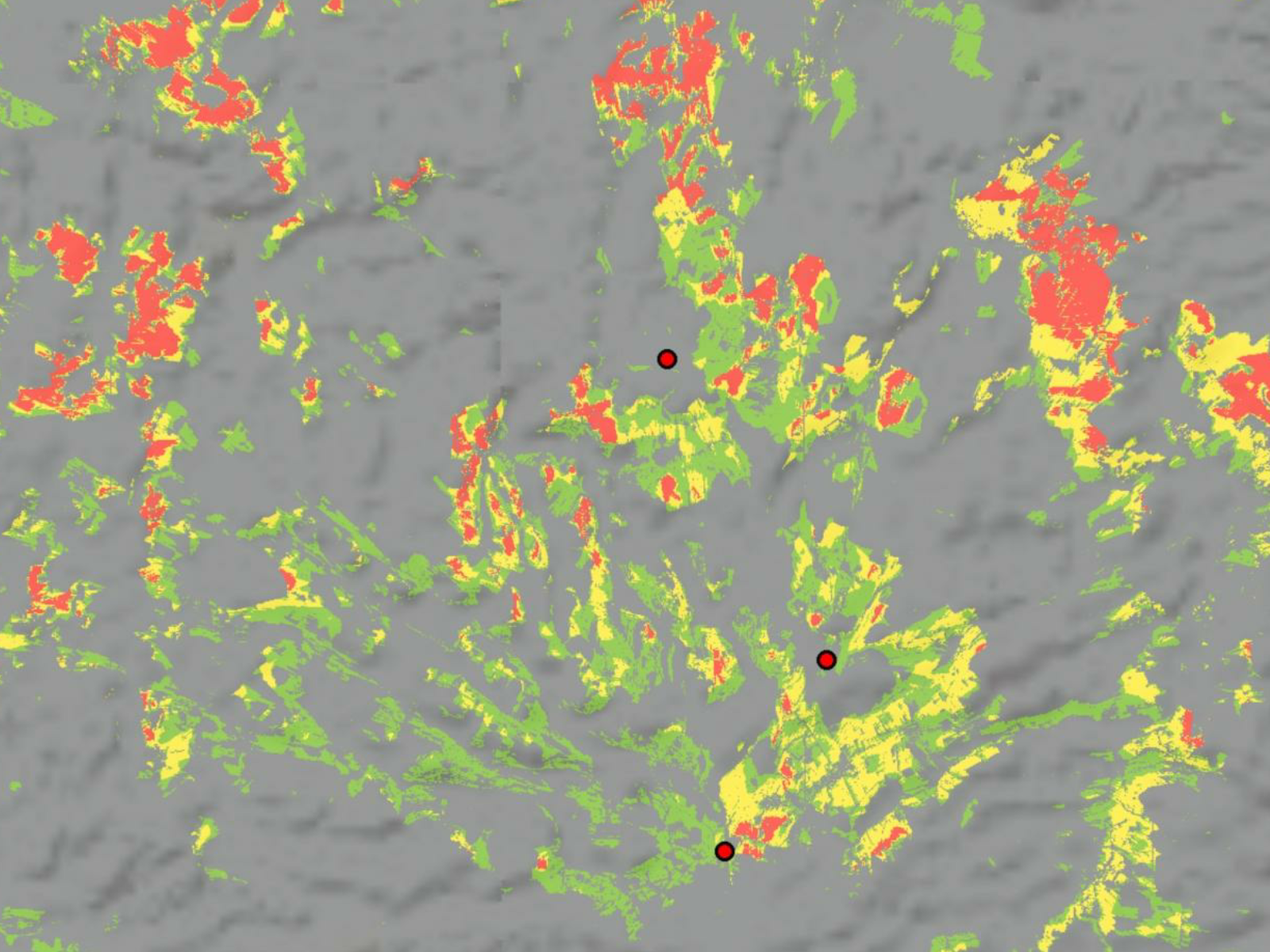
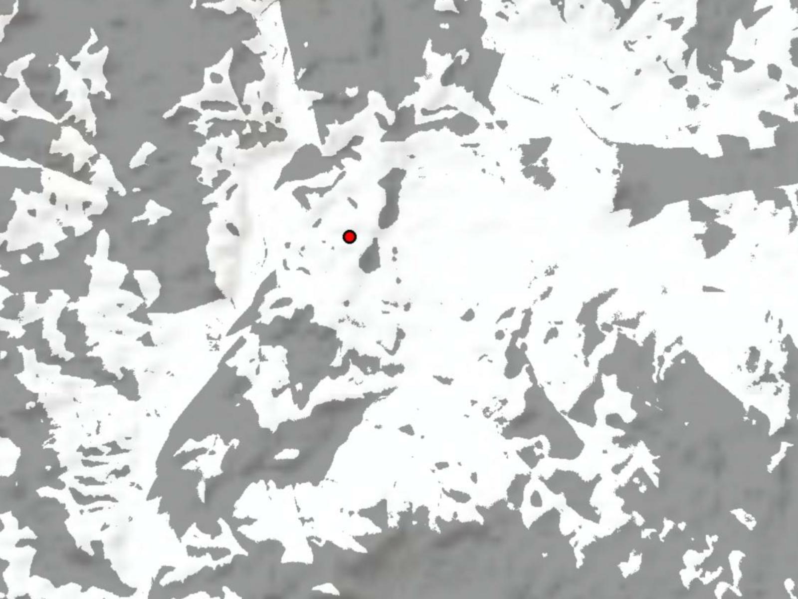
Visibility Analysis shows if radio masts, wind turbines, transmission lines, and other similar infrastructure installations are visible from a certain area. Perfect for infrastructure projects, Visibility Analysis produces a visibility map that is based on high-precision terrain data and analyzed with scientifically validated methods by the Institute for Landscape and Environment at Nuertingen-Geislingen University.
Product Description
Visibility Analysis plays an important role in assessing the impact of different infrastructures on planning projects. Based on high-precision digital terrain and surface data, Visibility Analysis enables assessing the visual impact of wind turbines, transmission lines, extensive solar power plants, and other structures in the planning process, predicting impacts on the visual landscape improving the quality and legal rigor of the planning process. The method was validated in cooperation with administrative authorities and companies.
Visibility Analysis offers comprehensive and affordable analyses to planning consultants that conduct Environmental Impact Analysis (EIA), developers that apply for planning permissions, and authorities responsible for planning at all government levels. They can include the visibility maps into their planning processes and determine the impact of different objects on landscape quality in a certain area. It is important to consider any possible impacts by the wind turbines on existing objects in the landscape or land-use plans.
Without buying and managing elevation data and geoprocessing software, customers can save time and expenses while getting reliable results within just a few working days.

Provider:
- Hochschule für Wirtschaft und Umwelt Nürtingen-Geislingen
Powered by
Off the shelf
Access mode
Format
Delivery time
Short text
Please note
- For the analysis, we will need some information concerning the infrastructure installation, e.g., for a single facility, only its height and position are required. Depending on the application, different types of viewshed and visibility analyses can be calculated and delivered in different data formats. For more complex installations, please provide us with a Shapefile of your area of interest. After ordering, you will get your results within a few working days.
- We are happy to consult you and to provide an individual offer. Just contact us.
Pricing / Licensing
The price is based on the size of the area for which the visibility is calculated and assumes a typical complexity:
- Communal planning: Maximum of 2 wind farms with 5 installations each
- Medium area planning: Maximum of 20 wind farms with up to 70 installations each
- Regional planning: Several 100s of installations
cloudeo Terms & Conditions apply.