

You are a planner at a major telecom company, tasked with preparing for a new 5G network What's the fastest way to find unobstructed lines of sight for new transmitters?
Starting at the end of 2018, telecommunication companies in the major big countries will start to roll out 5G coverage. Some 4G architecture can be used, but many older transmitters will need to be replaced to keep up with the major technological jump to 5G speeds.
You are a planner at a major telecom company tasked with preparing for a new 5G network. What's the fastest way to find unobstructed lines of sight for new transmitters?
Starting at the end of 2018, telecommunication companies in the major big countries will start to roll out 5G coverage. Some 4G architecture can be used, but many older transmitters will need to be replaced to keep up with the major technological jump to 5G speeds.
Worldwide coverage is expected to follow in 2020. (1)
Time for an upgrade
With the increase in frequency and bandwidth in RF radio links needed for 5G, accurate elevation datasets with high spatial detail, global coverage, and excellent vertical accuracy are required in the planning process. Luckily, there are brand new resources on the market that fit the bill.
Introducing NEXTMap Link Planning
cloudeo and Intermap Technologies now offer a unique, hassle-free, easy to use geo-service befitting the critical task at hand. Utilizing the highest accuracy data of the NEXTMap's ultra-high-resolution digital elevation models, the NEXTMap Link Planning web app by cloudeo is the best resource for point-to-point microwave and millimetre wave wireless telecom connectivity. Let's work on your project together
Simple solutions with NEXTMap Link Planning
Surface Snapshot
This is the NEXTMap Link Planning user interface in a standard browser.
Scroll through the different background map options. On the top left, 4 base maps are available: Esri Topographic, Open Street Map, Google Maps Roads, and Google Maps Satellite.
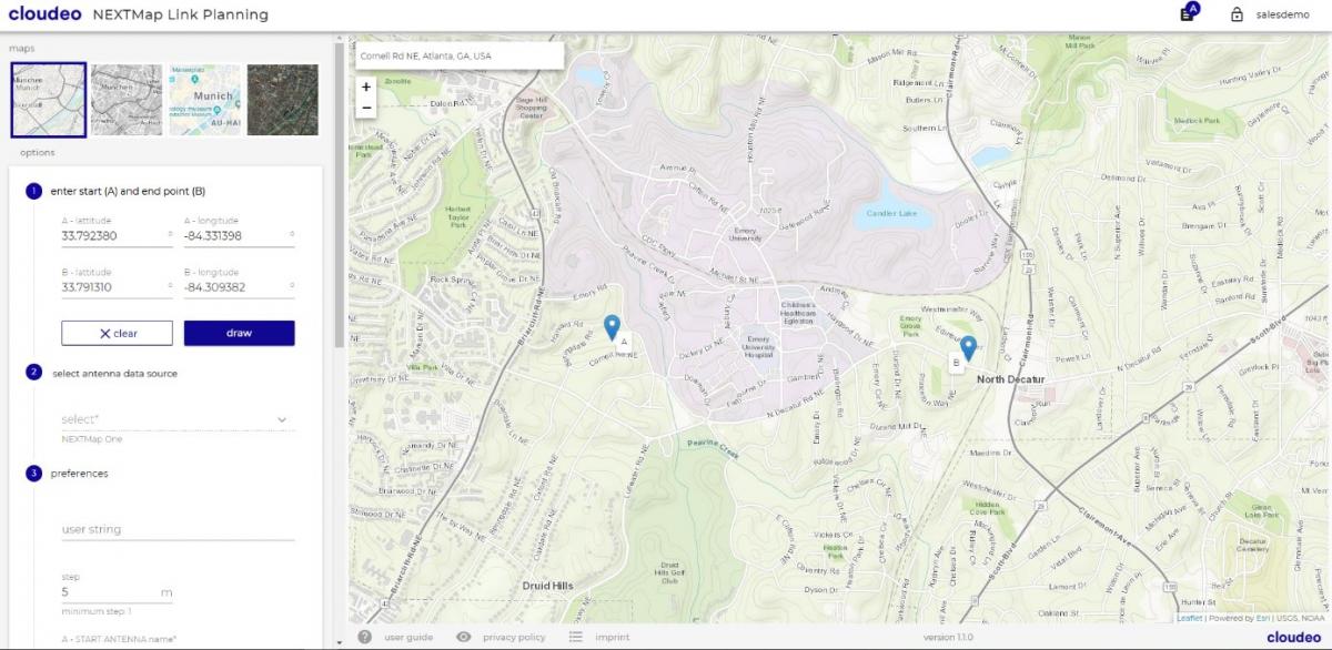
Step 1: Define points A and B. Points can be selected on the interactive map. Set point A off of Cornell Rd NE, and Point B as off of Decatur Rd. Click "Draw"
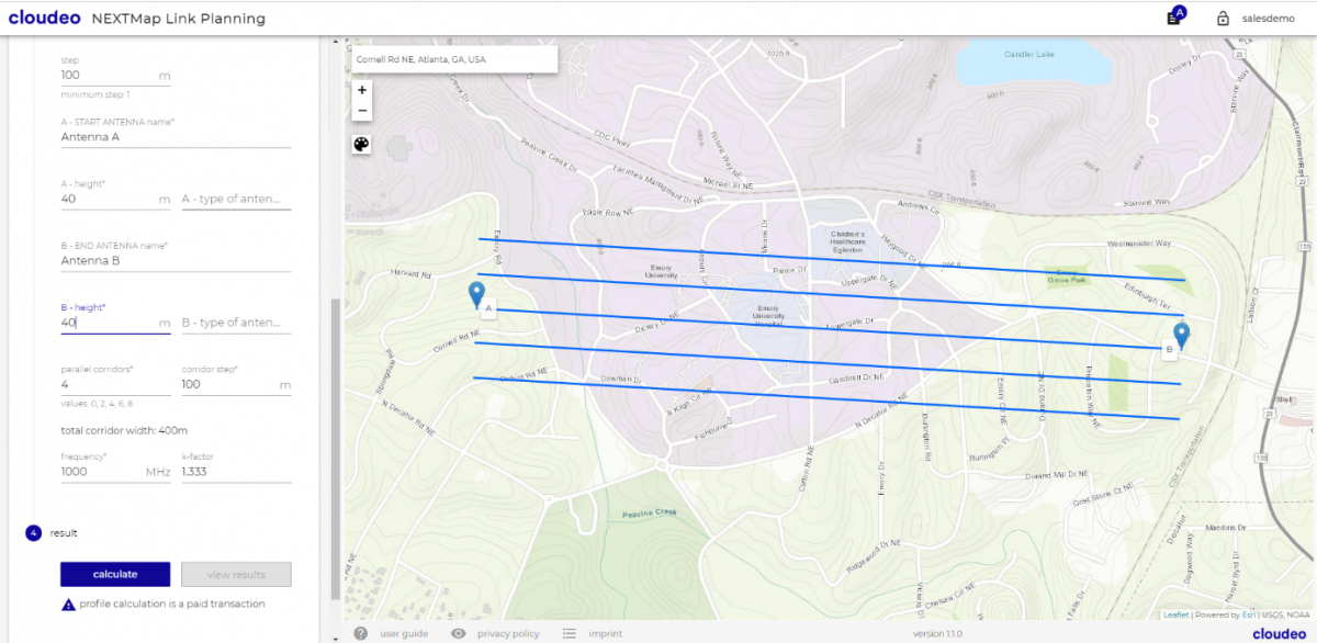
Step 2: Select a data source. Here, NEXTMap One DSM (digital surface model) has been chosen. The other option is the DTM (digital terrain model) at various resolutions. The highest available resolution is chosen by default.
Further constraints such as the potential height of both receivers and frequency of the waves can be specified. Adjust your desired step distance for the graph.
Instantly generate up to 9 parallel corridors at any step difference needed.
Step 3: Generate profile. Results are instantly provided as a customized graph with the line of sight (LOS).
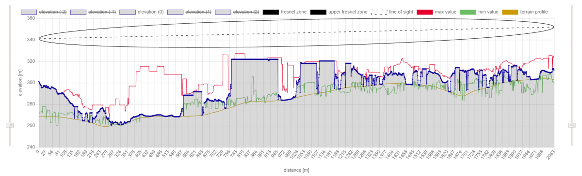
Is there a clear line of sight between these two points?
Using Intermap's clutter identification technology, it is possible not only to avoid larger buildings but also smaller obstructions such as trees. In this case, if a 40m tower on the neighbourhood were to communicate with another 40m tower near the main road 2100 meters away, would the connection be clear?
The graph is set to show on the Y axis both the height of the ground as well as the height of the towers. In this example, we see that there are no obstructions in the line of sight (solid black line) or Fresnel zone (red line). In blue, we see the terrain profile and the parallel corridors along the connection line. The LOS is unobstructed.
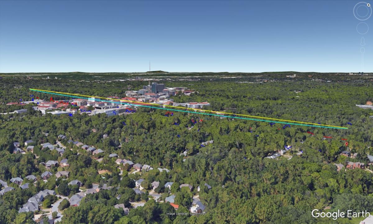
Export your results to .kml to view the line of sight in Google Earth.
Make your telecom project fuss-free today with cloudeo
NEXTMap Link Planning is built upon the architecture of the NEXTMap One DTM and DSM by Intermap Technologies. High spatial detail combined with seamless global coverage and an easy to use cloudeo web app creates the most powerful geo tools for telecom and a 5G rollout.
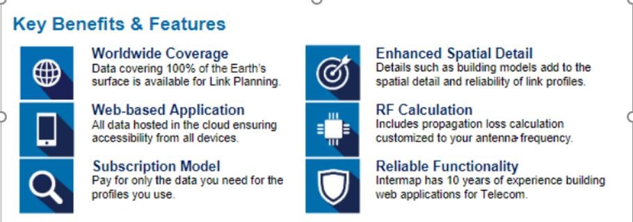
Just how accurate is NEXTMap elevation data? It provides data at up to 1-meter resolution (horizontal and vertical) with worldwide coverage enabling precise spatial analysis anywhere. It is accurate enough to pick out ground clutter such as trees and small buildings. Freshly created from strict quality management processes and only the newest technologies and sensors since 2016, it is also available as a standalone data product for countless other applications.
What's the difference between DSM and DTM? A DSM incorporates elevations of surface features like vegetation and buildings. DTM provides elevations of the bare earth where all surface features have been removed. Water bodies and coastlines are also flattened and corrected for accurate measurement.
How to order NEXTMap Link Planning
NEXTMap Link Planning is available with flexible pricing. Pay as you go and purchase only the quantity of profiles you need. Keep track of available profiles and use statistics directly in the cloudeo web app.
Click here to purchase: Link Planning