
Insurance & Finance
Natural Risk Insurance and Disaster Mitigation
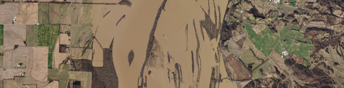
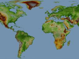
The insurance industry is increasingly embracing earth observation data to boost efficiency, estimate risk exposures, detect cumulated risk, and reduce time to assess the loss, especially in natural disasters. The better you estimate risk upfront and the earlier you know your exposure in a disrupted area, the better you can determine competitive insurance premium, can - in case of events - shift and allocate resources, get an alert of an unfolding crisis, and monitor it as it progresses. Insurers use earth observation data to establish real-time damage assessment over a large area without sending their field agents to these high-risk locations or helping their assessors to boost efficiency. This saves insurers time and cost, allows them to promptly assess their risk exposure, differentiate damaged & undamaged assets, and process claims more accurately. When responsiveness matters most, having the information insurers need to empower their people to exceed customers’ expectations is paramount, and satellite and aerial-based observation works as an enabler to help achieve this goal.
Location intelligence becomes relevant as insurance claims are 100% location-based. Geospatial insurance technology brings complete spatial awareness and real-time data to underwriters' fingertips and speeds up decision-making. The reinsurance industry is already moving in the direction of utilizing satellite imagery for loss prediction and assessment. New schemes like index-based insurances also cover risk in areas where historical damage data and an assessor network are missing. Additionally, technological advancements, coupled with a rapid expansion of satellite data and value-added services, like geospatial analytics, have rendered satellite images more affordable and versatile for use across various industries, including insurance.
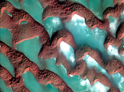
Earth observation data builds a knowledge repository to predict flood events and reduce the response rate, whether in a particular geography or worldwide. This is important in areas where no other technology could provide the speed and scale of satellite imagery.
Availability of satellite imagery before, during, or after an event allows the insurance company to assess the damage and shorten the timeline to assist the property owner during a time of need. This allows Hazard Insurance Claims Management to provide accurate and timely damage reports and weed out fraudulent claims, which might occur after such events.
The collection of such data would be mainly virtually impossible on the ground. We are fortunate to have a tremendous industry with geospatial capabilities that can mobilize and collect satellite imagery and other techniques like accurate elevation models over thousands of square miles of affected areas. Insurance companies can also monitor temporal land-use change for an enriched understanding of risk exposure using land use classification. Satellite imagery can help balance need, response time, and accuracy of a claim.
COMPETITIVE ADVANTAGE IN THE MARKET
Insurance companies looking to obtain a competitive edge can use earth observation data across the board - from topographic modeling to derived vegetation metrics.
These data sets can help insurers gain the advantage of understanding current and future risks to their investments and calculate the best insurance premium prices.
Benefits of Satellite Remote Sensing for Agri-Insurances and Agri-Management
Earth Observation satellites, optical and RADAR - all-weather, can capture data that traditional means cannot efficiently, such as
- Farm crop yields
- Mapping of crops
- Geotagging farmland to specific farmers
- Farm diversification
- Planting cycles and trends in production
- Satellite data can guide ground data and estimate yield at the village level
- Satellite data can reduce the transnational costs of reaching rural farmers and, ultimately, make finance more affordable for smallholder farmers
- Satellite imagery provides sufficient detail on clients without an established credit history to make lending decisions combined with demographics, financial, agronomic, geospatial, and psychometric data
- Post-loan support by utilizing satellite imagery to monitor the performance of loans through the cropping cycle
- Space-based data can reduce the cost, increase the credit approvals, and decrease turnaround time and non-performing loans
Agri-institutions could forecast revenues, potential repayment deficits, and income timing to access comprehensive and reliable data on factors like productivity, prices, and weather.
Agri Risk Management
Credit Risk ( Planting Crops, raise product, harvesting, market delivery)
 MAPSGEO sarl Do you need high-resolution imagery over a whole country or large area for your mapping project? Then 21AT Basemaps / LAM is perfect for the occasion. Since... |  cloudeo You have a plan and budget right now, which needs geo resources like data, software, or cloud resources within the next year, but you do not know exactly?... |  Airbus Defense and Space Elevation1 provides highly accurate up to 1.5m vertical accuracy at 1m grid spacing elevation information anywhere in the world, independent of relief and we... |
 Airbus Defense and Space Elevation30 is a unique worldwide 3D geographic reference database with a vertical accuracy down to 6m at 30m grid spacing specifically designed for large ar... |  Airbus Defense and Space Elevation4 provides highly accurate up to 3m vertical accuracy at 4m grid spacing elevation information anywhere in the world, independent of relief and weat... |  Airbus Defense and Space Elevation8 provides highly accurate with vertical accuracy down to 3m at 8m grid spacing elevation information anywhere in the world, independent of relief a... |
Hexagon Keep your high-resolution data locally with Hexagon Satellite imagery. Simply select your area of interest, the dataset you need, and get your data delivered... | Hexagon Keep your high resolution data locally with Hexagon Pixel Delivery. Simply select your area of interest, the dataset you need, and get your data delivered fa... |  Hexagon The HxGN Content Program Streaming Aerial Imagery Service provides login-only access to an extensive online library of 30 cm and 15 cm (urban areas) ortho-re... |
 SI Imaging Services Access 1-meter panchromatic (PAN) and 4-meter multispectral (MS) image repository data for various applications, gathered by a high-performance remote sensin... | 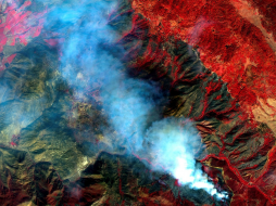 SI Imaging Services The latest high-performance remote sensing satellite images providing 1-meter panchromatic (PAN) and 4-meter multispectral (MS) image data for various applic... |  SI Imaging Services Providing 0.4-meter panchromatic (PAN) and 1.6-meter multispectral (MS) archived satellite image data for applications requiring extreme precision imagery ga... |
 SI Imaging Services Access 0.5 meter panchromatic (PAN) and 2 meter multispectral (MS) image data repository gathered by a high-performance remote sensing satellite for various... | 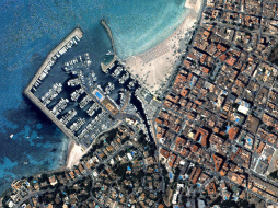 SI Imaging Services Providing 0.4-meter panchromatic (PAN) image and 1.6-meter multispectral (MS) image data for applications requiring extreme precision. Track detailed changes... | 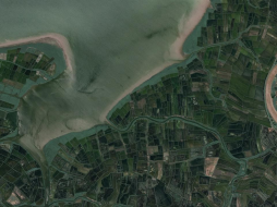 SI Imaging Services KOMPSAT-3 Tasking offers access to the latest images gathered by a high-performance remote sensing satellite providing 0.5-meter panchromati... |
 Novlum Inc. The high-quality 30-meter DTM maintains the input Digital Surface Model (DSM) seamlessly and void-free with flattened water bodies. NakedEarth... |  Airbus Defense and Space OneAtlas Analytics leverages premium Airbus satellite imagery, AI, and cloud computing technologies to extract actionable insight fast, in a cost-effective w... | 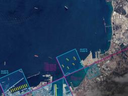 Airbus Defense and Space OneAtlas Data is a unique place for quick and easy access to updated High resolution satellite imagery and layers at your fingertips. Based on the Airbus con... |
 Planet Power your applications and analytics with seamless Planet Basemaps built from the most recent imagery over broad areas. With daily, global imaging, Planet s... |  Planet Frequent, global imagery is a powerful source of truth. But harnessing that data can be challenging, even for the most seasoned users, and manual, time-inten... | 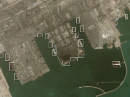 Planet Frequent, global imagery is a powerful source of truth. But harnessing that data can be challenging, even for the most seasoned users, and manual, time-inten... |