
Research & Academia
By bringing together maps, apps, data, and people, geospatial information allows everyone to make more informed decisions. By linking science with action, geospatial information enables institutes, universities, researchers, governments, industries, NGOs, and companies worldwide to innovate in planning and analysis, operations, field data collection, asset management, public engagement, simulations, and much more.
Areas of Engagement
Researchers use spatial information to trace urban growth patterns, access to mobility and transportation networks, analyze the impact of climate change on human settlements, and more. When spatial datasets are linked with non-spatial data, they become even more useful for developing applications that can make a difference. For instance, geospatial data coupled with land administration and tenure data can significantly impact urban planning and development by landowners.
For example, a recent project by the Government of India, 'The Swamitva Project,' uses geospatial data to provide an integrated property validation solution for rural India. 'Swamitva,' which stands for Survey of Villages and Mapping with Improvised Technology in Village Areas, uses Drone Surveying technology and Continuously Operating Reference Station (CORS) technology for mapping the villages. The project aims to provide the 'record of rights' to village household owners possessing houses in inhabited rural areas in towns, which would enable them to use their property as a financial asset for taking loans and other financial benefits from banks. The project stands to empower the rural peoples of India
Geospatial is also playing a crucial role in disaster management. By deploying geospatial data for all disaster management phases, including prevention, mitigation, preparedness, vulnerability reduction, response, and relief, significant disaster risk reduction and management can be achieved.
We are all aware that the damage can be catastrophic when a hail storm strikes. In fact, with damage totals sometimes exceeding USD 1 billion, hailstorms are the costliest severe storm hazard for the insurance industry, making reliable, long-term data necessary to estimate insured damages and assess extreme loss risks.
That's why a team of NASA scientists is currently working with international partners to use satellite data to detect hailstorms, hail damage and predict patterns in hail frequency. This project will provide long-term regional- to global-scale maps of severe storm occurrence, catastrophe models, and new methods to improve these storms' short-term forecasting.
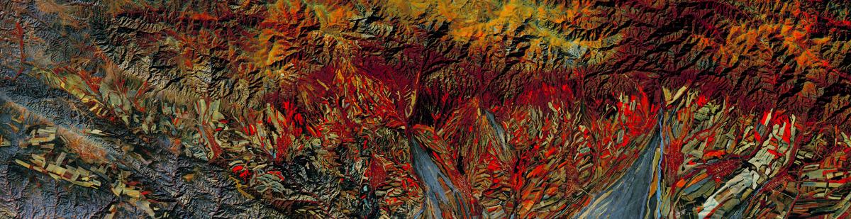
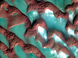
"We're using data from many satellite sensors to dig in and understand when and where hailstorms are likely to occur and the widespread damage that they can cause," shares Kristopher Bedka, principal investigator at NASA's Langley Research Center in Hampton, Virginia. "This is a first-of-its-kind project, and we're beginning to show how useful this satellite data can be to the reinsurance industry, forecasters, researchers, and many other stakeholders."Climate change is another area where research based on geospatial data is of extreme importance. The geospatial analysis not only provides visual proof of the harsh weather conditions, melting polar ice caps, dying corals, and vanishing islands but also links all kinds of physical, biological, and socioeconomic data in a way that helps us understand what was, what is, and what could be. For instance, air quality is a public health issue that requires ongoing monitoring. Not only does air quality data provide information that can protect residents, but it also helps to monitor the overall safety of a geographic area. NASA uses satellites to collect air quality data on an ongoing basis. The satellites can evaluate air quality conditions near real-time and observe different layers and effects that may coincide.
Satellite data can reveal information like the aerosol index and aerosol depth (which indicates the extent to which aerosols are absorbing light and affecting visibility) in any given area. Other types of data that satellites collect include levels of carbon monoxide, nitrous oxide, nitric acid, sulfur dioxide, fires, and dust.
Near real-time data helps to warn residents of low air quality. It can also be used to determine how climate change impacts a geographic area and guides new infrastructure design with climate change in mind.
Thus, there is hardly any living area where geospatial data or location intelligence cannot significantly impact. The more one engages in geospatial research, the more fascinating the journey of discovery becomes.
COVID-19 and Geospatial Research
The current pandemic has made each one of us realize the importance of geospatial data all the more. Be it identifying the hotspots, taking corrective measures sooner, and curbing the spread of the virus. Geospatial research has enabled the authorities to make headway more effectively in all spheres.
The location has been the answer to most of the problems. Thus more and more companies are now engaging in the development of apps that can help trace the virus and help businesses and individuals recover faster. Accordingly, researchers are increasingly engaging in projects that could bring such significant geospatial products to life soon.
Research bottlenecks due to COVID
Projects aiming to harness location intelligence's power have high-end hardware, software, and data requirements. Researchers typically have a high-end infrastructure at their disposal. These systems are placed either in their workplace or the universities where they are pursuing their research projects. These research hubs are also their gateway to highly accurate geospatial data. In regular times, they do not need to look anywhere else. However, the scenario is completely changed due to the pandemic. With the universities remaining closed for a long time, researchers are more dependent on the online availability of good quality infrastructure and data. As a result, platforms providing Data as a Service (DaaS), Software as a Service (SaaS), Infrastructure as a Service (IaaS) solutions are becoming popular among the research community.
Meeting hardware requirements
Lockdown and closure of educational institutions have brought researchers face-to-face with the lack of high-end infrastructure required for processing geospatial data. In such a scenario, researchers rely more and more on platforms that can provide the convenience of Infrastructure as a Service (IaaS).
Hardware is becoming less and less essential in the age of cloud computing. Cloudeo's Infrastructure as a Service (IaaS) solutions can help the researchers streamline their hardware requirements, save costs, and increase their research work efficiency. With Cloudeo's Infrastructure as a Service, a researcher needs to pay only for what they need. This helps in minimizing investment in local infrastructure. They can also quickly and dynamically adapt the processing power or storage they need, spreading big processing jobs over many cores. This is something that they might not accomplish (or afford) with their physical hardware. While using this service, all the data gets backed up securely in the cloud and remains protected from unexpected critical hardware failures.
Meeting geospatial data requirements
Researchers need access to platforms that can provide high-quality geospatial data from multiple sources at a low cost. Cloudeo's DaaS is emerging as an increasingly popular solution among researchers for accessing precious data from various sources, like suppliers of spaceborne, airborne, and UAV imagery and data. It's a cost-effective solution as the users do not have to buy permanent licenses for EO data integration, management, storage, and analytics. Data as a service is especially advantageous for short-term projects, where long-term or permanent licenses and data purchases can become cost-prohibitive.
Over the past few years, more and more Earth Observation (EO) data, software applications, and IT services have become available from an increasing number of EO exploitation platform providers – funded by the European Commission, ESA, other public agencies, and private investment.
For instance, ESA's Network of Resources (NoR) supports users in procuring services and outsourcing requirements while increasing uptake of EO data and information for broader scientific, social, and economic purposes. The goal is to support the next generation of commercial applications and services.
Cloudeo acts as the NoR Operator, together with its consortium partners RHEA Group and BHO Legal, by managing service providers' onboarding into the NoR Portal. The portal is a compilation of the NoR Service Portfolio, listing services on the NoR Portal, promoting the NoR services worldwide, and procuring such services for commercial users and ESA sponsorship.
Through NoR, cloudeo plays a vital role in improving and supporting education, research, and science. It is promoting community building by enabling collaboration between all stakeholders.
Research is crucial for the growth of an economy. As businesses mostly realize the importance of integrating geospatial with everyday affairs, research in the field of geospatial is gaining momentum. Accordingly, the need for access to high-quality geospatial data is also increasing. While most universities are equipped to meet these researchers' needs in regular times, with the current lockdowns and closure of institutions, the researchers rely on robust, accurate online platforms that can meet their hardware, software, and geospatial data requirements. Cloudeo is one such reliable platform for accessing geospatial data from disparate sources. It can also complete the infrastructure requirements of researchers effectively. By bringing in all the data creators, data processors, data users, and solution/app developers onto one platform, cloudeo is creating the most user-friendly geospatial solutions marketplace to meet the infrastructure, software, and data needs of researchers.
Explore cloudeo today and take an essential step towards excelling in your research and academic endeavors. No one can tell you about everything spatial so accurately! MAPSGEO sarl Do you need high-resolution imagery over a whole country or large area for your mapping project? Then 21AT Basemaps / LAM is perfect for the occasion. Since... |  Cloudflight Processing huge amounts of data can consume a lot of time and resources. We help you to spot your performance issues and speed up your algorithms. |  CATALYST - A PCI Geomatics brand Our rich set of capabilities are designed for today's top geospatial professionals in REMOTE SENSING. PHOTOGRAMMETRY and EARTH OBSERVATION SCIENCE. C... |
 cloudeo You have a plan and budget right now, which needs geo resources like data, software, or cloud resources within the next year, but you do not know exactly?... |  Airbus Defense and Space Elevation1 provides highly accurate up to 1.5m vertical accuracy at 1m grid spacing elevation information anywhere in the world, independent of relief and we... |  Airbus Defense and Space Elevation30 is a unique worldwide 3D geographic reference database with a vertical accuracy down to 6m at 30m grid spacing specifically designed for large ar... |
 Airbus Defense and Space Elevation4 provides highly accurate up to 3m vertical accuracy at 4m grid spacing elevation information anywhere in the world, independent of relief and weat... | 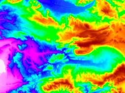 Airbus Defense and Space Elevation8 provides highly accurate with vertical accuracy down to 3m at 8m grid spacing elevation information anywhere in the world, independent of relief a... | 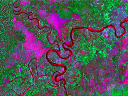 L3Harris Geospatial The Geospatial image analysis software used by GIS professionals, remote sensing scientists, and image analysts to extract meaningful information from satell... |
 VTT |  VTT |  VTT |
Hexagon Keep your high-resolution data locally with Hexagon Satellite imagery. Simply select your area of interest, the dataset you need, and get your data delivered... | Hexagon Keep your high resolution data locally with Hexagon Pixel Delivery. Simply select your area of interest, the dataset you need, and get your data delivered fa... |  Hexagon The HxGN Content Program Streaming Aerial Imagery Service provides login-only access to an extensive online library of 30 cm and 15 cm (urban areas) ortho-re... |
 SI Imaging Services Access 1-meter panchromatic (PAN) and 4-meter multispectral (MS) image repository data for various applications, gathered by a high-performance remote sensin... | 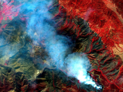 SI Imaging Services The latest high-performance remote sensing satellite images providing 1-meter panchromatic (PAN) and 4-meter multispectral (MS) image data for various applic... |  SI Imaging Services Providing 0.4-meter panchromatic (PAN) and 1.6-meter multispectral (MS) archived satellite image data for applications requiring extreme precision imagery ga... |
 SI Imaging Services Access 0.5 meter panchromatic (PAN) and 2 meter multispectral (MS) image data repository gathered by a high-performance remote sensing satellite for various... |  SI Imaging Services Providing 0.4-meter panchromatic (PAN) image and 1.6-meter multispectral (MS) image data for applications requiring extreme precision. Track detailed changes... |  SI Imaging Services KOMPSAT-3 Tasking offers access to the latest images gathered by a high-performance remote sensing satellite providing 0.5-meter panchromati... |