
Infrastructure
With the rapid rise in population and other socio-economic effects, the infrastructure industry shows unprecedented growth. With this growth comes the increasing push for integrating geospatial context information into infrastructure planning and management. With more and more buildings, roads, and other infrastructure elements getting added to the Earth’s map, they need to understand the geospatial context of infrastructure is becoming all the more necessary.
Geospatial technologies play a significant role in reducing risks and improving infrastructure projects' viability. Analysis of geospatial data provides additional insight to engineers and architects, helping the stakeholders reduce costs and risk and improve efficiency.
Using spatial information, people from different construction lifecycle sections can create digital models that help create a typical project picture. These shareable models allow improved coordination among the stakeholders.
Drones and high-resolution satellites have revolutionized the process of surveying and mapping construction sites. No matter where you are located, you can easily monitor your construction site’s progress using these data. Drones can capture high-quality data in less time using high-resolution camera payloads and related mapping solutions. Using this data, work progress reports can be prepared with quality images.
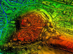
What’s more? Drone and high-resolution satellite data can also help the construction project stakeholders create digital surface models, digital terrain models, and 3D models. These models facilitate a more in-depth analysis of the work in progress at the site.
Urban Planning and Geospatial Data
A direct consequence of urbanization is the increase in the number of people living and working in cities and the corresponding infrastructure development. This leads to variations in cities, both spatially and temporally. To develop updated city plans, it becomes necessary for government officials, planners, decision-makers, and researchers to acquire quantifiable records for any city’s spatial growth and temporal change.
Geospatial data can help identify changes in land uses’ geographical features or behavior over a specified time. Such information allows professionals to make more informed decisions related to the development condition of an area. They can then plan accordingly.
Satellite remote sensing data are widely used to study and monitor land features, natural resources, and the dynamic effects of human activities on urban areas. A comprehensive base map of the city and adjacent regions indicating physical characteristics may be prepared quickly with satellite imagery. It can be kept current by applying efficient satellite-based change detection. Geospatial data also plays a vital role in resource management, environment monitoring, land use, and planning activities. Remote Sensing provides reliable, timely, accurate, and periodic data, which helps create different planning scenarios for efficient decision making. Geospatial technologies provide the required input and intelligence to prepare base-maps, make planning proposals, and act as a monitoring tool during the implementation phase of any urban planning scheme.
Geospatial data can significantly help elaborate suitability for constructing specific construction sites such as bridges or dams. Feasibility studies of smaller structures like schools and hospitals can also be carried out effectively using location intelligence. It can also be used to ascertain the feasibility of an area for waste disposal and treatment. The application areas remain unlimited.
Sustainable Cities and Geospatial Data
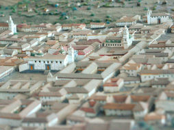
The world is moving towards the development of smart cities. These cities seek to provide a better living experience to the residents and fostering sustainable development. Sustainability remains a crucial goal of smart cities, and intelligent and green infrastructure automatically becomes the need of the hour.
All this requires efficient planning, and geospatial data is a crucial component of the planning process. The cities’ digital twins can be created, leading to more effective city architectures using cloud data.
For instance, the Moscow government used a blend of publicly available cloud data and privately collected and refined data from drones and data collection vehicles driving through Moscow streets for a digital twin creation. 3D visualization of Moscow’s whole powered by UNIGINE 2 became a very accurate representation of the city geometry and different layers like traffic, energy, and economic factors.
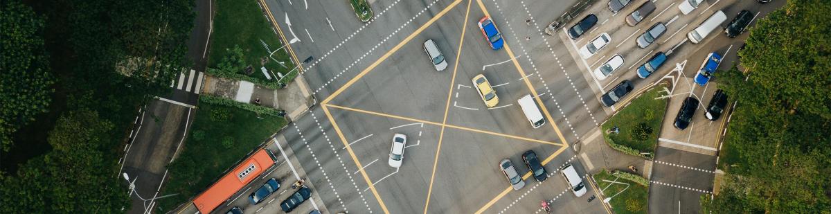
Transport Infrastructure and Geospatial Data
Robust transport infrastructure is a mandatory requirement of a sustainable city. Transport Infrastructure is of critical importance to a country’s economic growth. With a rise in people and goods’ movement each passing day, there is a need to create a sustainable and resilient transport network. When it comes to creating a robust railway or road network, geospatial data plays a vital role. This is why Innovate UK selected Hexagon’s Geospatial division to conduct a research project that could lead to faster and higher-precision mapping of its railway infrastructure. The project was expected to enable Network Rail to automatically identify and measure railway structures from LiDAR data, saving valuable time and resources while also improving planning and operations across the rail network.
More Resilient infrastructure with Geospatial Data
An Infrastructure that is durable, resilient, and can withstand disasters are necessary components of future cities. Geospatial technologies offer solutions that are safe, sustainable, and environment friendly. With the escalating threats of natural disasters, it is becoming essential to invest in the right infrastructure of the best quality.
For instance, consider the ‘Room for the River’ initiative of the Netherlands. Nearly 30% of the Netherlands is below sea level, and another 30% is vulnerable to flooding along its rivers. This initiative involves making room for rivers in 30 locations by creating space for floodwaters, creating diversions for excess, and restoring riverine landscapes. Also, in Iowa, climate change information is being used to assist in urban planning and infrastructure design. Satellite data primarily helps in bringing such goals to fruition.
Monitoring Illegal Construction using Geospatial Data
Governments and municipalities need tools to detect illegal construction activity early, and this is another area where satellite data can help them effectively. Satellite data allows continuous monitoring of changes within an urban environment. Governments can quickly identify new constructions and demolitions in an area by frequently monitoring sites with satellite data. This data helps them identify encroachments and other illegal constructions rapidly, and thus timely actions can be taken.
Cloud-based Geospatial Analytics
Geospatial data gathered in construction are usually of large spatial scales. Storage, processing, and analysis of these data often become a challenging task. This is where cloud computing platforms having access to large cloud providers provide much-needed help to the infrastructure industry. One such platform is Cloudeo.
 MAPSGEO sarl Do you need high-resolution imagery over a whole country or large area for your mapping project? Then 21AT Basemaps / LAM is perfect for the occasion. Since... |  cloudeo Pre-installed latest GIS Mapping Software ArcGIS Pro on cloudeo`s Workbench supports data visualization; advanced analysis... |  CATALYST - A PCI Geomatics brand Our rich set of capabilities are designed for today's top geospatial professionals in REMOTE SENSING. PHOTOGRAMMETRY and EARTH OBSERVATION SCIENCE. C... |
 cloudeo You have a plan and budget right now, which needs geo resources like data, software, or cloud resources within the next year, but you do not know exactly?... |  Airbus Defense and Space Elevation1 provides highly accurate up to 1.5m vertical accuracy at 1m grid spacing elevation information anywhere in the world, independent of relief and we... |  Airbus Defense and Space Elevation30 is a unique worldwide 3D geographic reference database with a vertical accuracy down to 6m at 30m grid spacing specifically designed for large ar... |
 Airbus Defense and Space Elevation4 provides highly accurate up to 3m vertical accuracy at 4m grid spacing elevation information anywhere in the world, independent of relief and weat... |  Airbus Defense and Space Elevation8 provides highly accurate with vertical accuracy down to 3m at 8m grid spacing elevation information anywhere in the world, independent of relief a... | 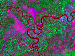 L3Harris Geospatial The Geospatial image analysis software used by GIS professionals, remote sensing scientists, and image analysts to extract meaningful information from satell... |
Hexagon Keep your high-resolution data locally with Hexagon Satellite imagery. Simply select your area of interest, the dataset you need, and get your data delivered... | Hexagon Keep your high resolution data locally with Hexagon Pixel Delivery. Simply select your area of interest, the dataset you need, and get your data delivered fa... |  Hexagon The HxGN Content Program Streaming Aerial Imagery Service provides login-only access to an extensive online library of 30 cm and 15 cm (urban areas) ortho-re... |
 Novlum Inc. The high-quality 30-meter DTM maintains the input Digital Surface Model (DSM) seamlessly and void-free with flattened water bodies. NakedEarth... |  Intermap Technologies Provides seamless digital elevation data with data coverage for 40 countries at 5-meter resolution and reduces costs with time-limited licenses and no minimu... | 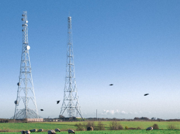 Intermap Technologies The geo service NEXTMap Analytics – Profile provides quick and easy access to terrain profiles anywhere on the globe. Visualize the topograp... |
 Intermap Technologies The geoservice NEXTMap Analytics – Value provides precise elevation information at any point in the world. Based upon highly accurate NEXTM... |  Intermap Technologies The geospatial service NEXTMap Analytics – Viewshed provides instant 360° communications coverage map, visibility, and obstruction analysis... |  Intermap Technologies Wireless network design and the installation of antennas requires an understanding of the best possible location and height of communication towers so that n... |
 Intermap Technologies High-resolution terrain models give planners a reliable and accurate (one-meter resolution) planning tool to ensure the best possible assessment of a projec... |  Intermap Technologies High-resolution terrain models give planners a reliable and accurate (one-meter resolution) planning tool to ensure the best possible assessment of a project... | 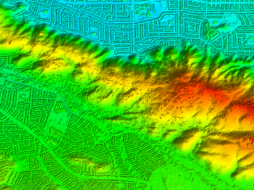 Intermap Technologies NEXTMap One™ offers the most recent and up-to-date digital elevation models, with one-meter resolution, for every state in the US (excl. A... |