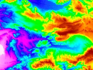
Elevation8 provides highly accurate with vertical accuracy down to 3m at 8m grid spacing elevation information anywhere in the world, independent of relief and weather conditions, on-demand for your area of interest. Whether planning an infrastructure network, conducting a military intervention mission in unknown terrains, or analyzing terrain features for oil and gas exploration: accurate terrain height information is critical.
Product Description
Precise and reliable elevation data supports a wide range of applications and forms the foundation of any accurate geospatial product. Airbus Elevation8 simplifies access and use of elevation data and provides exactly the right model for your project requirements. It is ideally suited for mapping, hydrology, and exploration of natural resources.
Elevation8 is derived from SPOT6/7 Stereo or Tristereo optical satellite data with vertical accuracy down to 3m at 8m grid spacing. It is available as a Digital Elevation Model (a model of the ground that includes both ground and above ground features like buildings, vegetation, etc). The Digital Terrain Model (representing the bare Earth elevation, vegetation, and man-made objects removed) is also available.
The satellite’s optimized combination of wide-area coverage and high-resolution image acquisition supports the rapid collection of imagery and delivery of products. The models are available tailored exactly to your Area of Interest (AOI) starting at a minimum of just 1,000km².
Provider:
- Airbus Defense and Space
Posting
Vertical accuracy
Horizontal accuracy
Access mode
Delivery time
Please note
Minimum order size 1000km².
Contour lines only available for DTM and Bundle.

