
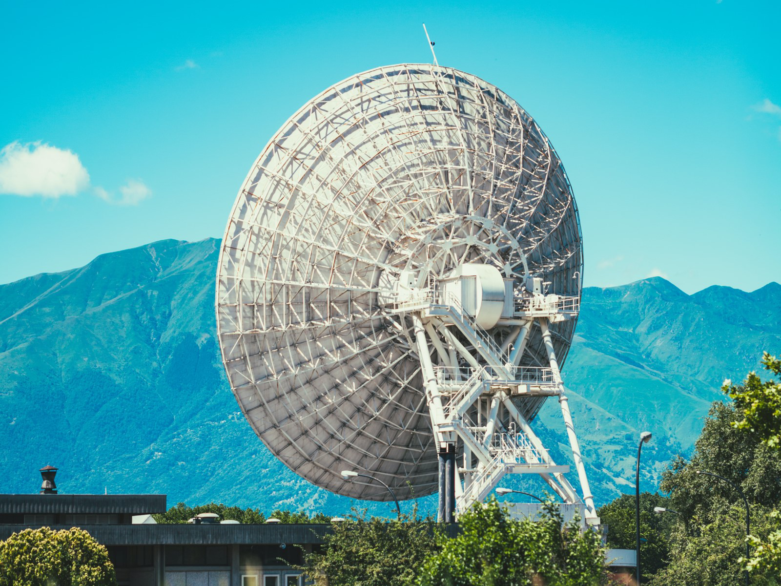
The geospatial service NEXTMap Analytics – Viewshed provides instant 360° communications coverage map, visibility, and obstruction analysis around any point on the globe. These viewsheds are based on Intermap’s NEXTMap elevation data; they produce highly accurate and reliable results necessary for telecommunication connectivity. Viewshed, part of the NEXTMap Analytics web app, lets you specify transmitter and receiver information to generate a detailed and colorized viewshed for any point, anywhere in the world.
Product Description
Without the need to manage and host the base data, the NEXTMap Analytics - Viewshed web app allows you to perform complex viewshed analysis in just a few seconds, instead of minutes or hours, like with other commercial GIS tools. And there will be no need to spend time and money for field crews to survey an area first – with NEXTMap Analytics – Viewshed you can visualize precisely, using just your computer, where visibility is obstructed throughout the entire communication range.
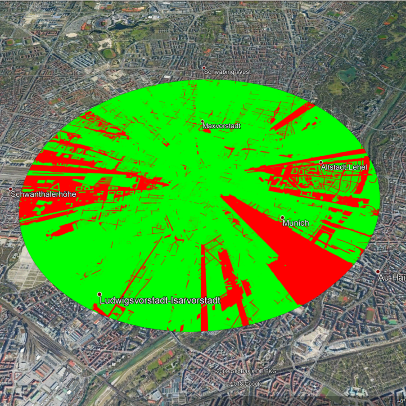
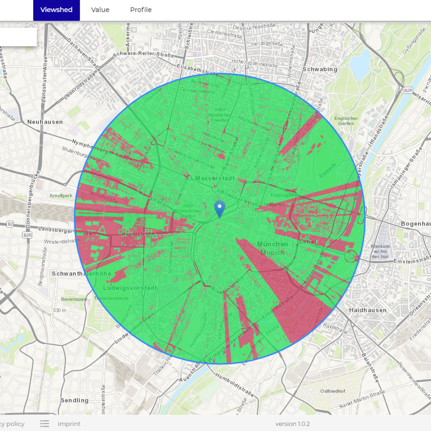
The viewshed is adjustable to include up to 360° visibility, or any specified viewing angle, around a given point. Areas highlighted in green indicate that the visibility would be unobstructed, while areas in red mean that the line-of-sight could have interference. Results are visible within the app and exportable to .KMZ to view in Google Earth.
The NEXTMap Analytics – Viewshed service is particularly useful for users in the telecommunication industry looking for information on terrain/surface structure. Combined with our other services Profile and Value - all accessible through our cloudeo NEXTMap Analytics web app - Viewshed provides you with comprehensive information for line-of-sight and microwave link design when planning for new towers and upgrading existing network coverage.
Provider:
- Intermap Technologies
Powered by
Off the shelf
Resolution
Abs vertical accuracy
Access mode
Data format
Links
Please note
- The viewsheds expire after the subscription period.
- Larger viewshed quantities are available with additional volume discount on request. License restrictions may apply for risk assessment applications.
Pricing / Licensing
Intermap EULA and cloudeo Terms & Conditions apply.