
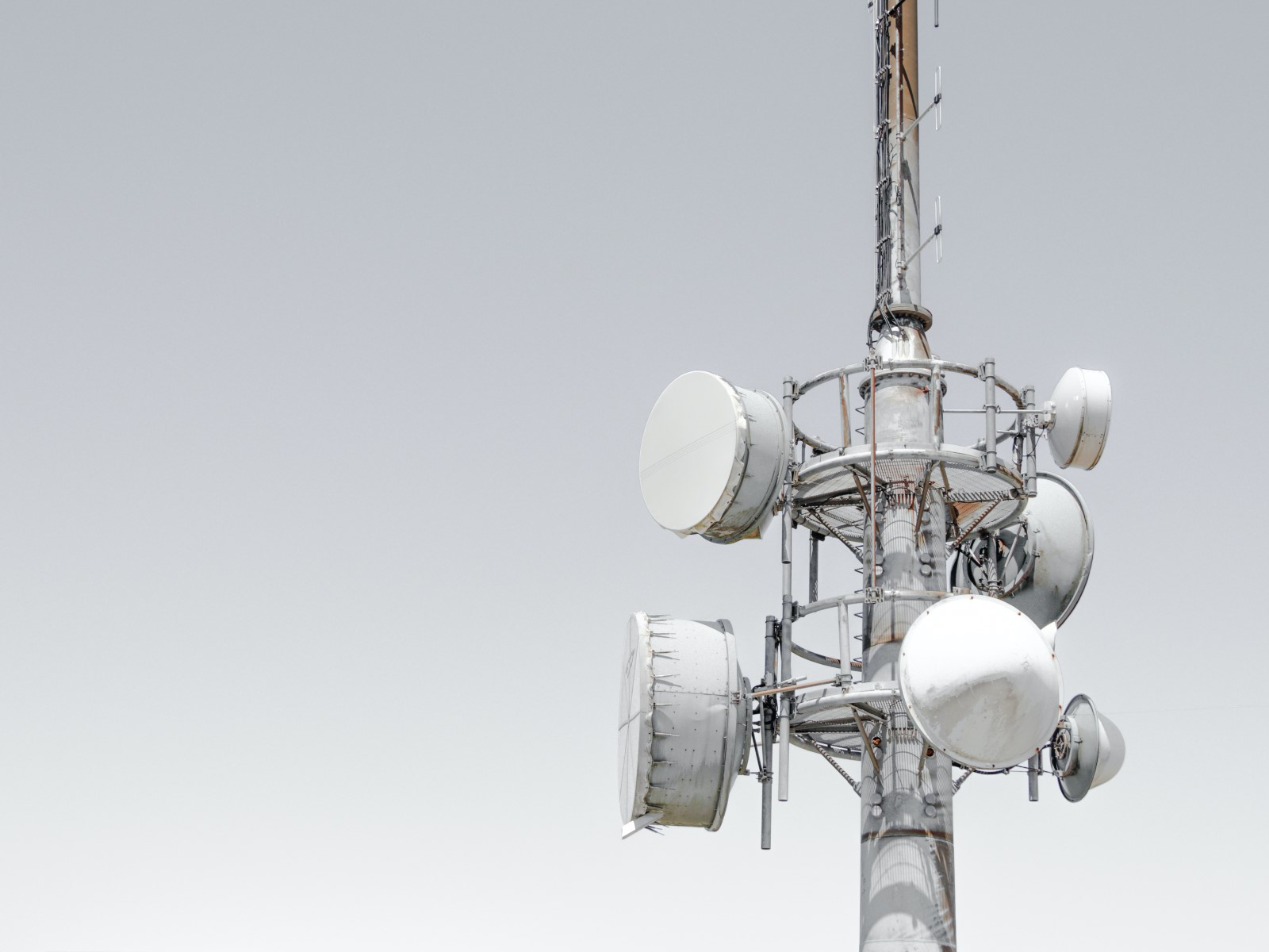
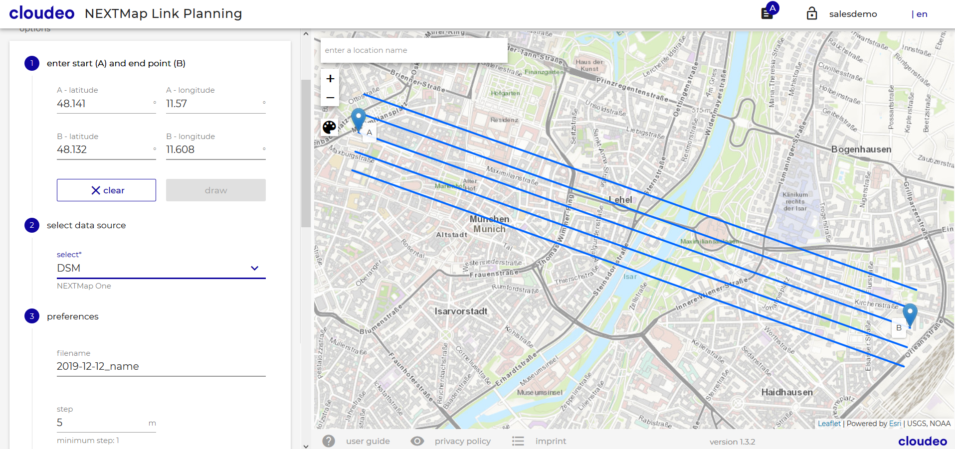
Wireless network design and the installation of antennas requires an understanding of the best possible location and height of communication towers so that no obstructions, such as mountains, trees, or buildings, interrupt the path between the antennas and the signal. The NEXTMap Link Planning web app, powered by Intermap, allows you to quickly and efficiently identify such obstructions. Instead of labor-intensive site surveys, using RF link planning allows telecom companies and network planners to save costs by planning and checking the line of sight quickly and easily, without even leaving the office.
Product Description
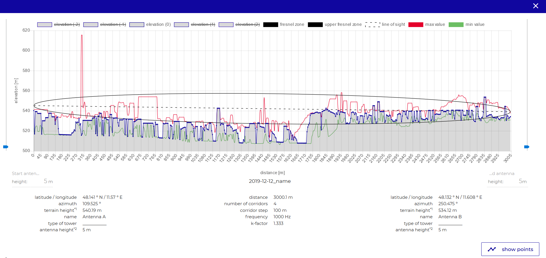
Wireless network design and the installation of antennas requires an understanding of the best possible location and height so that no obstructions, such as mountains, trees, or buildings, interrupt the path between the antennas and the signal. The service visualizes the Fresnel zone and determines if any interference exists due to landforms between two planned locations of antennas or telecoms towers. NEXTMap Link Planning is especially beneficial for any user in the telecommunications industry, like mobile, TV, broadband, radio, and emergency service providers, using terrain profiles for the line of sight and microwave link design for new towers and upgrading existing networks coverage.
With the increase in frequency and bandwidth in RF radio links, accurate elevation data sets with great spatial detail, global coverage, and excellent vertical accuracy is required. Intermap’s data provides a solid foundation for link planning as it is seamless, uniform, and void-free. The elevation dataset is created using Intermap’s strict quality management process and provides the user with spatially rich features such as buildings, flattened roads, and natural terrain. It is available globally and is ready for use in your network planning.
Using the web app NEXTMap Link Planning, customers can leverage the best available NEXTMap datasets to assess their point-to-point microwave and millimeter-wave wireless products. Online access takes data management out of your hands and allows your focus to find your customers' right hardware and location.
Provider:
- Intermap Technologies
Powered by
Off the shelf
Resolution
Abs vertical accuracy
Access mode
Data format
Links
Please note
- The profiles expire after the subscription period.
- Larger profile quantities are available with additional volume discount on request. License restrictions may apply for risk assessment applications.
Pricing / Licensing
Intermap EULA and cloudeo Terms & Conditions apply.