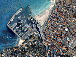
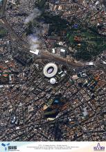
Providing 0.4-meter panchromatic (PAN) image and 1.6-meter multispectral (MS) image data for applications requiring extreme precision. Track detailed changes over time over your area of interest with KOMPSAT-3A’s frequent revisit time of just 3 days.
Product Description
The KOMPSAT-3A satellite was developed by KARI (Korea Aerospace Research Institute) and launched in 2015 to continue the conservation program of the KOMPSAT mission. With 0.4-meter resolution for panchromatic and 1.6-meter resolution for multispectral data (R, G, B, and NIR), KOMPSAT-3A was the first satellite in the KOMPSAT constellation with two imaging systems on board. Data from this satellite are best for applications in defense, mapping, infrastructure monitoring, agriculture, automated feature extraction, and disaster monitoring. KOMPSAT-3A has an average revisit rate of 3 days, less than 20° off nadir, over the same area.
KOMPSAT-3A packages can easily be customized. Select between two delivery options: the pansharpened set or the bundle of the panchromatic (PAN) and the 4 multispectral (MS) channels. Choose between different data acquisition modes and repetitive acquisitions for monitoring; the Kompsat-3A Archive offers research discounts or multi-user licenses for larger enterprises.
For time-based licenses, a Workbench, your virtual machine configured for geoprocessing, is required. Workbench saves time and expenses for new hardware, software management, and data acquisition. Access your Workbench from any device anywhere in the world. For more information about the Workbench, please click here.
For archived imagery, please refer to KOMPSAT-3A Archive.
Permanent data licenses are available upon request. Please contact us.
Provider:
- SI Imaging Services
Off the shelf
On demand
Resolution
Access mode
Format
Delivery time
Downloads
Product details
- Data specifications
- PAN: 450 ~ 900 nm
- MS1 (B): 450 ~ 520 nm
- MS2 (G): 520 ~ 600 nm
- MS3 (R): 630 ~ 690 nm
- MS4 (N): 760 ~ 900 nm
- Quantization: 14 bits/pixel
- Map projection / Datum: UTM / WGS84
- Location accuracy: 7.38 m RMSE, <11.2 m CE 90 with POD/PAD
- Sensor
- Orbit: Sun synchronous
- Altitude: 528 km
- Inclination: 98.14 deg
- Local acquisition time: 01:30 pm
- Swath width: 13 km (nadir)
- Default parameters
- Cloud coverage: ≤15%
- Snow and ice: ≤10
- Haze and sand wind: yes
For universities, an academic discount is available. Please provide a short description of your project if you wish to apply for this discount.
KOMPSAT Product Level
- 1R (Radiometric Correction)
Level 1R is the product corrected for radiometric and sensor distortions. The difference of relative radiometric response between detectors is corrected and internal detector geometry and mis-registrations between detectors are corrected when applicable.
- 1O (Ortho-Ready)
- 1O is only available for KOMPSAT-3 and KOMPSAT-3A. Ortho ready imagery is projected to a plane using map projections and datum, radiometric and sensor corrections are also applied. Geometric corrections project the image to a constant base elevation, which is calculated on the average terrain elevation per order polygon.
- 1G (Georectified without GCP)
- Level 1G is the product corrected for geometric distortions and projected to UTM. Processing for Level 1G includes all radiometric corrections and sensor corrections applied to Level 1R processing. Optical distortions are corrected and terrain effects are corrected using coarse DEM, namely SRTM DEM for level 1R.
Please note
Beyond the standard options individual product configurations are possible. Our GeoExperts are standing by to optimize the product configuration according to your needs. Just contact us.
- Different data acquisition modes, including stereo imagery to derive 3D models
- Repetitive acquisitions for monitoring purposes
- Multi-user licenses for larger enterprises
- Volume discounts for larger areas available
- If you would like to use the product for development, please visitKOMPSAT Development
- For time licenses, a Workbench is required. The Workbench is not included in the calculated price. Please configure it separately and add to your cart: Workbench. If you already have a Workbench, just contact us.
- Permanent data licenses are available upon request. Please contact us.
Pricing / Licensing
The pricing is an indication only and depends on area, length of time licenses, and number of required scenes. The final pricing is subject to a feasibility study and number of users. As soon as we get your request, we will contact you to provide a binding quote.
KOMPSAT-3 EULA and cloudeo Terms & Conditions apply. In addition, for time licenses only, it is prohibited to download the product or any derived data sets, which would allow reverse-engineering of the product. For all other derived data sets, you can request download directly through cloudeo checkout.
