
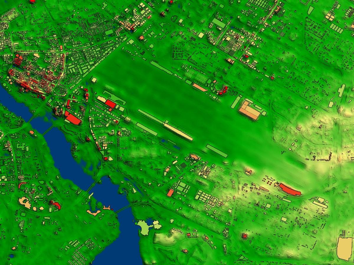
Topographic, obstacle, and aerodrome information are combined to create a single, global terrain dataset at 6-meter resolution. Lido Surface Data NEXTView™ is the only high-resolution, global digital surface model (DSM) certified for the aviation industry. Released in 2019, NEXTView is powered by Intermap’s world-class NEXTMap processing engines and incorporates Lufthansa Systems’ global airport database in terrain computations. This significantly increases the quality of data around aerodromes, where accuracy is vital.
Product Description
NEXTView improves situational awareness, safety and efficiency for airborne and ground operations with its 6-meter horizontal resolution and 3-meter LE90 or better vertical accuracy. Users can perform accurate height-above-ground calculations, simulations and flight planning. The dataset is 25x – 200x more detailed than current global aviation solutions and is continually updated and quality-checked.
NEXTView benefits applications such as flight planning, procedure design and performance analyses, as well as charting, navigation, simulation, emergency landing site evaluation, drift-down procedure calculations, and UAV/drone and UTM operations. NEXTView data can be streamed directly into users’ applications for seamless integration.
NEXTView was designed to suit aviation industry standards and meets or exceeds the regulatory requirements of ICAO Annex 15. The model includes billions of embedded obstructions, such as buildings, mountain peaks and trees as well as detailed aerodromes and runways. NEXTView is also available with a release statement documenting the EASA Service Provider Type 1 Certificate for seamless integration into avionics systems. For certified delivery for avionics use cases, please contact us.
NEXTView requires a cloudeo workbench to access. For more information about the Workbench and add it to cart, please click here.
Provider:
- Intermap Technologies
Coverage
Post Spacing
Vertical Accuracy
Vertical Resolution
Horizontal Accuracy
Please note
Please contact us for subscriptions longer than 1 year and for orders larger than 50,000km².
Minimum order of 1000€ (200km² AOI) is required.
Pricing / Licensing
Intermap EULA and cloudeo Terms & Conditions apply.