
High-resolution terrain models give planners a reliable and accurate (one-meter resolution) planning tool to ensure the best possible assessment of a project’s impact. In densely populated and highly developed regions like France, any large-scale planning project is inevitably complex and potentially contentious. NEXTMap One™ France is available with time-based licenses, and planners can also keep their costs in check.
Product Description
NEXTMap One™ France from Intermap is more accurate than traditional map-based models and provides planners with insights that go far beyond what naturally meets the eye. This 3D terrain dataset provides complete coverage for all of France, with seamless data at one-meter resolution. NEXTMap One™ enables high-precision spatial analysis, with or without surface features like buildings or vegetation. Digital Surface Models (DSMs) include all surface elevations from terrain, vegetation, and human-made features, such as buildings and infrastructure. Digital Terrain Models (DTMs) show the bare earth after all surface features have been digitally removed. These digital terrain models are advantageous as analytical tools in densely populated and highly developed areas like France.
Both DSM and DTM are ideal for mapping, visualization, and analysis. They are used in telecommunication, aviation, geology, forestry, natural resources management, infrastructure planning, and emergency response; DTM is commonly used in applications like orthorectification, 3D visualization, watershed analysis, environmental risk analysis, and cartography.
NEXTMap One™ is accessible on the Workbench, your cloud-hosted IT infrastructure configured for geoprocessing. For more information about the Workbench, please click here.
Permanent data licenses are available upon request. Please contact us.

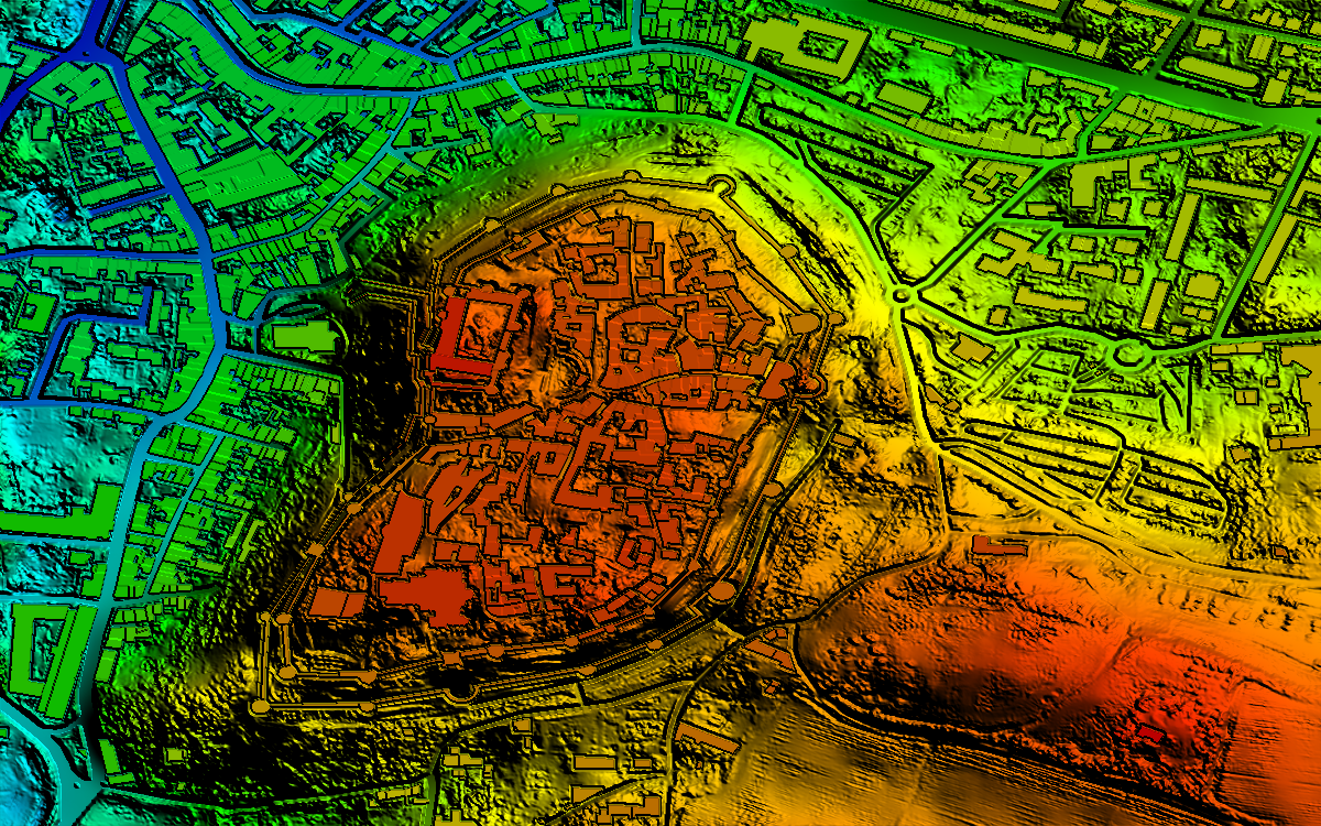
DTM - Dunkirk

DSM - Paris

DSM - Versailles
Provider:
- Intermap Technologies
Off-the-shelf
Posting
Vertical accuracy (Regional)
Horizontal accuracy (Regional)
Projection
Datum
Geoid
Access mode
Format
Delivery time
Downloads
Please note
- For time licenses, a Workbench is required. The Workbench is not included in the calculated price. Please configure it separately and add to your cart: Workbench. If you already have a Workbench, just contact us.
- Other areas are available upon request.
- Please contact us for orders above 10,000 €.
- API is available upon request.
- Permanent data licenses are available upon request. Please contact us.
Pricing / Licensing
The Intermap Web Services EULA and cloudeo Terms & Conditions apply.