
Aviation
Currently, the amount of technological advancement that the world is witnessing is astounding. An essential part of this development is the growth of the drone and the aviation industry. Drones are getting more often used for surveillance, photography, deliveries, etc. As drone applications increase, the drone industry turns to satellite imagery and geospatial data to optimize its planning, operations, maintenance, and security efforts. To the same extent, planning and managing autonomous flights – manned or unmanned- is making huge steps forward.
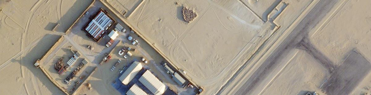
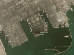
Drones for Factory Surveillance
More and more industries are relying on drones for factory surveillance. Drones help the factories monitor real-time activities at any time of the day or night while sitting in any corner of the world. The main advantages of using drones instead of traditional factory surveillance methods are their dynamic placement, the bird's eye view that they can provide, and continuous situational awareness. Factory surveillance through drone technology is much more feasible in terms of costs and ease of use.
Drone Taxis
As shown in sci-fi movies, drones have become a reality for transporting people as a private vehicle and a part of a public transport system. Drones have many advantages over heavy-weight airplanes, especially for short distances and, for example, in Urban Air Mobility (UAM), representing a very challenging environment.
The lighter weight of drones makes them more maneuverable in flight and landing. Drone taxis can fly at low altitudes, and with proper maneuvering, they can be easily saved from running into obstacles. Satellite imagery can help in the easy detection of obstacles. With the concept of travel by drone not yet becoming popular, there is no chance of traffic congestion in the airspace currently. Even when the situation changes, satellite data can primarily help in drone traffic management.
With the rise in drone usage, their safe flight planning and management becomes even more critical, and this is where satellite data can play an unmatched role.
Safer Autonomous Flying with remote sensing
A requirement for safe autonomous flying is up-to-date and precise data regarding obstacles and potential landing spots, integrated into flight planning and operations. Digital Surface Models (DSM) with clutter information and high-resolution satellite imagery can be essential sources.
Remote sensing enables drone operators to prepare a flight plan by providing broader information coverage than traditionally surveyed.
Remote sensing can help provide information about building locations and other obstacles that can hamper and endanger drone operations within a particular area. Using LiDAR, you can have highly accurate elevation data, which is critical for drone operations. Multispectral imagery can mainly help in assessing the natural environment around a drone's flight path. Information about trees that can grow to become obstructions, wetlands in potential construction areas, or vegetation that can attract birds are critical for safe drone flight operations. Satellite imagery can aid in getting a good understanding of such information.
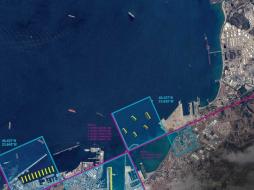
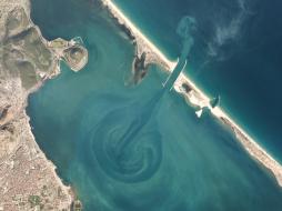
Better Management of Air Traffic
Geospatial technology can play an essential role in controlling air traffic. Location data can enable drones to coordinate with each other and avoid collisions. This could aid in the easy rerouting of air traffic as necessary.
The trend of using satellite data for safer drone operations is picking up. For instance, Altitude Angel, the UTM (Unmanned Traffic Management) technology provider, and Inmarsat specializes in global mobile satellite communications, recently collaborated to develop and deliver an advanced flight tracking and management capability for drones.
The two companies intend to build on Altitude Angel's GuardianUTM platform and develop a 'Pop-Up UTM' capability, which can be deployed anywhere required to manage Beyond Visual Line of Sight (BVLOS) operations. Various other companies are working in parallel on similar projects.
Flying Beyond Visual Line of Sight (BVLOS) more safely
Beyond Visual Line of Sight (BVLOS) operation is picking up as a standard requirement in many industrial and mission-critical applications. Unlocking BVLOS operations in autonomous drones is creating new use cases and enhanced performance scenarios in various applications.
Be it disaster management, precision agriculture, law enforcement, or insurance, more and more industries consider BVLOS as the future for managing operations. For instance, the wide-area surveillance capability that BVLOS offers allows insurers to assess losses in disaster-stricken neighborhoods safely and quickly.
However, the deficit of confidence in the safe operation of BVLOS remains a critical hurdle on their path to getting more ubiquitously adopted. In the absence of a pilot's view, these drones face higher risks of collisions and accidents. This is where high-resolution satellite data can help. The drones can gain enhanced situational awareness using accurate satellite imagery, informing them about the obstacles and helping them reroute as and when necessary. High-resolution, up-to-date data leads to improved planning and increased situational awareness during the flight. This simplifies the process of mapping routes and finding appropriate landing spots.
Where to find high-quality Geodata for safe drone operations?
So, there remains no doubt that is using high-quality geospatial data. The drone and aviation industry can achieve a high operational excellence level in planning and managing flight operations. Geospatial data can also significantly aid in air traffic management and BVLOS operations.
However, an important question arises here: 'Where can I get high-quality geospatial data that meets these needs most effectively?'
One answer is cloudeo.
 Airbus Defense and Space OneAtlas Data is a unique place for quick and easy access to updated High resolution satellite imagery and layers at your fingertips. Based on the Airbus con... | 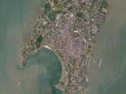 Planet Power your applications and analytics with seamless Planet Basemaps built from the most recent imagery over broad areas. With daily, global imaging, Planet s... | 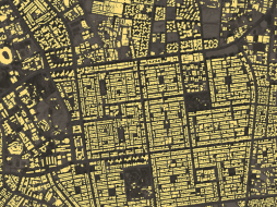 Planet Frequent, global imagery is a powerful source of truth. But harnessing that data can be challenging, even for the most seasoned users, and manual, time-inten... |
 Planet Frequent, global imagery is a powerful source of truth. But harnessing that data can be challenging, even for the most seasoned users, and manual, time-inten... | 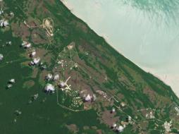 Planet Access and download past imagery from the PlanetScope Archive catalogue over any area of interest. PlanetScope satellites capture daily imagery going back to... | 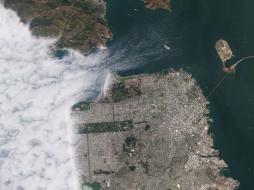 Planet Stay ahead in today’s rapidly evolving business landscape with a persistent view of business operations and assets – everywhere on Earth. But traditional ima... |
 Planet Select 10,000km² of PlanetScope satellite imagery al a carte. Perfect for projects with strict scopes and deadlines, customers can pre-pay for imagery, past... |  Airbus Defense and Space Pleiades is an optical satellite constellation providing very high-resolution products (50cm) with a 20-km swath. Both the space and the ground segment have... |  Sparkle Have you always wanted to use AWS but didn't want to run over budget? Then Prepaid AWS Cloud is for you. Prevent cost overruns by pre-purchasing just the amo... |
 Planet Access the rich archive of imagery from the longest running satellite in the Planet catalogue, RapidEye. Perfect for a “high level” overview, the 5-meter res... |  cloudeo To get a literal “high-level overview” of any plot of land (for example, to monitor long-term and short-term changes from construction, infrastructure, or na... |  Planet With an industry-leading combination of coverage and cadence, Planet delivers Earth imaging data at unprecedented scale. Planet’s 15 SkySat satellites gather... |
 Planet Get a snapshot of your area of interest to discover patterns, detect early signals of change, and make timely, informed decisions. With 15 SkySat satellites... |  Airbus Defense and Space The SPOT imagery products offer high resolution over broad areas using the SPOT satellites. An acquisition covers large areas in a single pass at resolutions... |  Airbus Defense and Space TerraSAR-X reliably provides high-resolution SAR imagery with a resolution of up to 0.25m independent of weather conditions and illumination. The products al... |
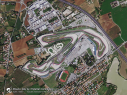 21AT TripleSat Constellation Archive has the right tools when you need a time-series of images to map or monitor your area of interest. You can r... |  21AT TripleSat Constellation Tasking has the right tools when you need a time-series of images to map or monitor your area of interest. With a st... |  Sparkle Workshop and Training Solutions is the best way to host your internal and external company training remotely and securely, without paying for aging physical... |
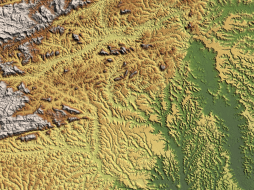 Airbus Defense and Space WorldDEM™ is a 12m Digital Surface Model (DSM) with unprecedented quality, accuracy and coverage. WorldDEM™ provides a reliable and precise reference layer t... | 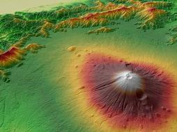 Airbus Defense and Space WorldDEM™ Streaming grants global access to WorldDEM™ (12m) and WorldDEM4Ortho (24m) via streaming. Browse, discover, and experience the global WorldDEM™ dat... |